<?xml version="1.0" encoding="utf-8"?><feed xmlns="http://www.w3.org/2005/Atom" ><generator uri="https://jekyllrb.com/" version="3.10.0">Jekyll</generator><link href="https://pazadam.github.io/feed.xml" rel="self" type="application/atom+xml" /><link href="https://pazadam.github.io/" rel="alternate" type="text/html" /><updated>2026-03-10T16:19:51+00:00</updated><id>https://pazadam.github.io/feed.xml</id><title type="html">VIA-TARIQ</title><subtitle>Research on Roman, Medieval, and Ottoman transport networks in the Levant</subtitle><author><name>Adam Pažout</name></author><entry><title type="html">New publication!</title><link href="https://pazadam.github.io/news/2026/03/10/publication/" rel="alternate" type="text/html" title="New publication!" /><published>2026-03-10T00:00:00+00:00</published><updated>2026-03-10T00:00:00+00:00</updated><id>https://pazadam.github.io/news/2026/03/10/publication</id><content type="html" xml:base="https://pazadam.github.io/news/2026/03/10/publication/"><![CDATA[<p>After more busy months I can finally announce first publication stemming purely from the VIA-TARIQ project! <strong>Pažout, A. Using Archaeological Road Data to Evaluate Limits of Topography on Road Location: Roman Roads in the Near East as a Test Case. <em>J Archaeol Method Theory</em> 33, 28 (2026).</strong> <a href="https://doi.org/10.1007/s10816-026-09766-4">https://doi.org/10.1007/s10816-026-09766-4</a> The article was published in Open Access, so you can reach it without problems on the indicated link.</p>

<p>The idea behind this article is quite simple: since we have digital spatially detailed and accurate data for ancient roads, we should be able to isolate the variables that influenced the location of roads in the landscape from bottom to top, using inductive approach. This sentence also explains why this was not really possible before (at least not at such a scale): until the <a href="https://itiner-e-org">Itiner-e</a> was released in November 2025 there was no such dataset available for this kind of inquiry.</p>

<p>For starters, I am focusing only on selected topographic variables, namely slope, topographic position index (TPI), and local vector ruggeddness measure (VRML), to get a better grasp of how much do these variables contribute to the selection of where in the landscape the road will be located. This is especially interesting test case as slope is typically employed as the main variable dictating the road location and practically all least cost path algorithms are based on it.</p>

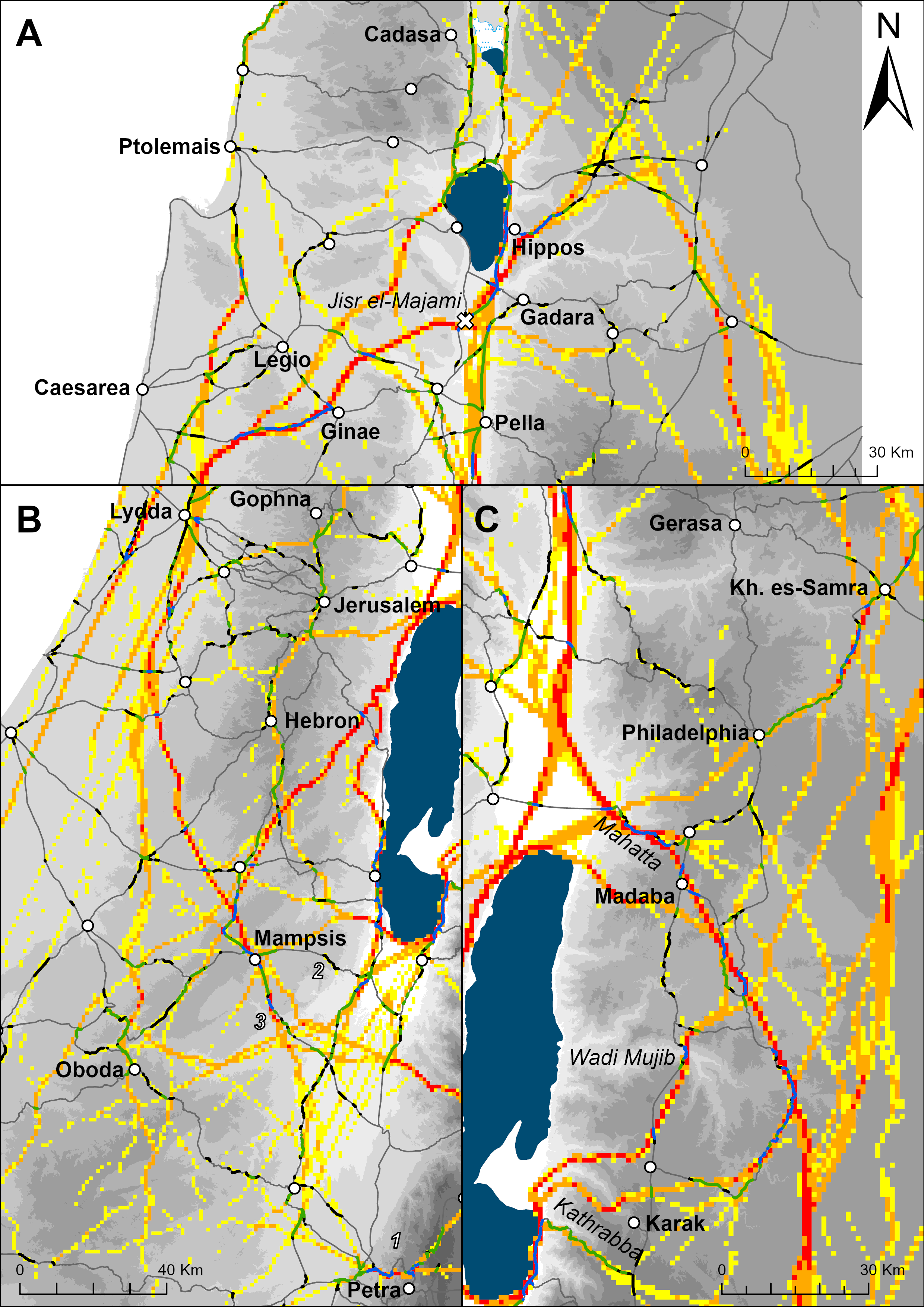
<p>The results show that the combination of these three variables can explain around ~25% locations of the Roman roads in the southern Levant (roughly provinces Judaea and Arabia). As the picture below clearly shows, the model has more explanation power in hilly and mountainous terrain (unsurprisingly) but even here there are some significant deviations which shows that even in areas of considerable topographic variance, topography is only one of the contributing factors influencing the road location.</p>

<p>I am particularly happy that the model can predict well locations of quite few mountain passes but also crossings of the deep canyons in modern day Jordan (Wadi Mujib, Wadi el-Hasa). But for (semi-)desert and flat regions clearly different model would be more suitable. My thinking is going in direction of settlement structure and networks (as you could see in my previous <a href="https://pazadam.github.io/news/2025/09/08/summer-eaa/">post</a>) and water availability, while some micro-topography features probably also played a role (but that is hard to approach using contemporary DEMs available for the regions. Well, more research is needed!</p>

<p>Read the rest in the article!</p>

<p><img src="/assets/images/publication.png" alt="Overlay between modelled movement corridors and Roman roads" /></p>]]></content><author><name>Adam Pažout</name></author><summary type="html"><![CDATA[After more busy months I can finally announce first publication stemming purely from the VIA-TARIQ project! Pažout, A. Using Archaeological Road Data to Evaluate Limits of Topography on Road Location: Roman Roads in the Near East as a Test Case. J Archaeol Method Theory 33, 28 (2026). https://doi.org/10.1007/s10816-026-09766-4 The article was published in Open Access, so you can reach it without problems on the indicated link.]]></summary></entry><entry><title type="html">Looking back at this summer and some reflections on EAA 2025</title><link href="https://pazadam.github.io/news/2025/09/08/summer-eaa/" rel="alternate" type="text/html" title="Looking back at this summer and some reflections on EAA 2025" /><published>2025-09-08T00:00:00+00:00</published><updated>2025-09-08T00:00:00+00:00</updated><id>https://pazadam.github.io/news/2025/09/08/summer-eaa</id><content type="html" xml:base="https://pazadam.github.io/news/2025/09/08/summer-eaa/"><![CDATA[<p>Days are getting shorter and nights colder, clear sign that summer is slowly coming to an end and autumn, and new academic year, is coming. In my last <a href="https://pazadam.github.io/news/2025/06/15/conferences/">post</a> I mentioned that my summer in fact is going to be quite busy as I need to work on a least-cost path network model of the Roman roads in the Levant and prepare for presenting it at the <strong>EAA (European Association of Archaeology) conference</strong> that unfolded last week (2-6 September). And busy summer it was…</p>

<p>My idea was to try different network construction techniques to model theoretical LCP networks, such as Delaunay triangulation (DT), Gabriel graph (GG), Relative Neighbourhood graph (RNG) and K-nearest neighbours (K-NN) and compare them with the network structure of the Roman road network in the southern Levant - which is exceptionally well researched and described and so is very likely closest to the “real” road network as it existed in the Roman period. In the next step then, we may attempt to reconstruct Roman road network in a region where we now little about the ancient road network and “fill the gaps” using appropriate network construction method. Of course it was not that simple…</p>

<p>Sometimes you get too little edges (RNG), or too many (DT), or it overconnects sites within a single cluster (K-NN). Interestingly Gabriel graph comes closer to represent the Roman road network in the Levant with some 80% of Roman roads correctly predicted. This is quite important, since recently it was argued in an article by <a href="http://dx.doi.org/10.1016/j.jasrep.2017.07.024">Groenhuijzen and Verhagen (2017)</a> that Gabriel graph is the best approximation of the potential Roman transport network on the Dutch limes. So my analysis independently confirms their conclusions.</p>

<p>However, I was not really content with Gabriel graph since since some major roads were not present in this model and I was looking for alternative approaches. I found these in two articles by Carroll and Carroll <a href="https://doi.org/10.5334/jcaa.88">2022</a> and <a href="https://doi.org/10.1016/j.jasrep.2023.104140">2023</a>. In short, they introduce L coefficient representing ratio between built and travel costs. Road between two points is created only if there is no “cheaper” route through a third point and this is evaluated using L coefficient and travel costs between the three points. Another option is connecting sites to pre-defined “trunk” roads using T-junctions and employing similar comparison of travel costs as in the first case.
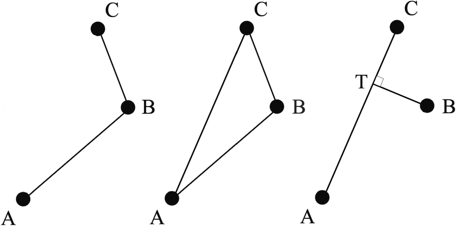
<img src="/assets/images/carrolls.png" alt="Carroll and Carroll" />
I was quite impressed with the results, where for L=4 some 80% of Roman roads are correctly predicted, but then there were some gaps not appearing in some of the previously modeled networks. So in order to fill the gaps in L=4 network I combined it with Gabriel graph and voilà we get about 86% of edges in the Roman road network, which seems amazing! This is interesting, since Carroll and Carroll claims that L=7 best represents the Roman road network in their researh region, so on this my results diverge from them… The big con of this method is the number of edges (=roads) that is generated and that vastly outnumbers the number of edges in the original Roman network. So the next step is validation and further pruning of edges. At the same time I want to try the T-junction method with pre-defined “trunk” roads - mainly in order to get some of the major roads that are still missing from L=4 network into the model.
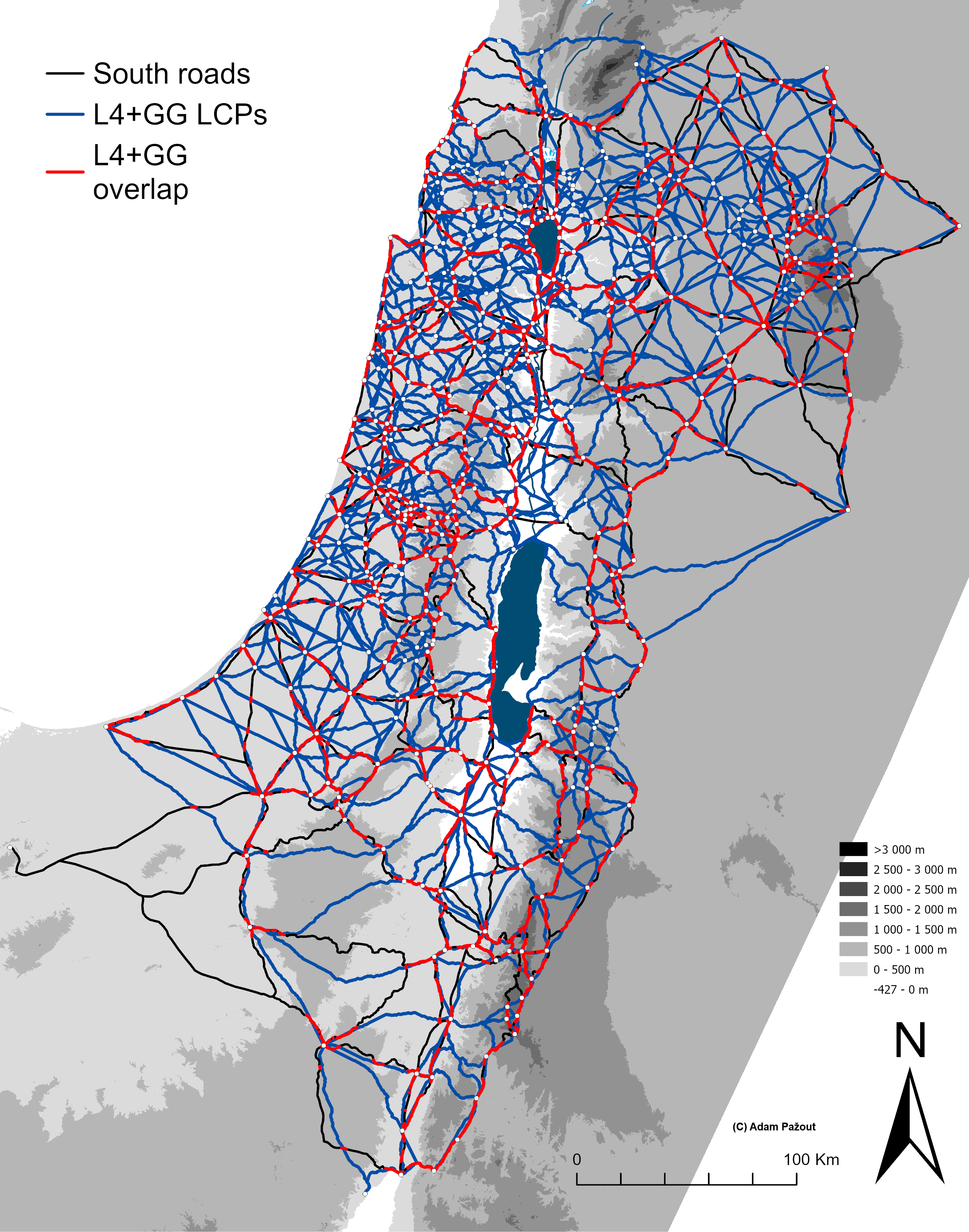
<img src="/assets/images/lcp_networks.png" alt="L=4+GG" /></p>

<p><strong><em>EAA Conference 2025</em></strong>
This year’s EAA was… disappointing, and some aspects of it left me quite annoyed.
But first of all I need to express big thanks to Andrew McLean, James Page and María Coto for organizing our amazing session <strong>“Moving forward: New applications and developments in archaeological mobility studies”</strong> with so many interesting papers ranging from isotope studies to advanced spatial methods, and including my humble contributions on LCP networks.
But that’s probably the only good thing I can say about the EAA. This year’s conference was completely online with all accompanying problems - poor connection on the side of some participants, poor microphones (so that whole presentation is totally incomprehensible), weird and totally useless experiments (playing your presentation from an iphone is not ok), bad and barely functional online platform, and generally just lack of social contact and discussions with friends and colleagues in between session. I do understand why Serbian colleagues decided not to organize in-person conference in Belgrad in light of police violence and disruptions to academic and university life in the city, and I want to express my support to the people of Serbia in their struggle against their corrupt political elites. At the same time I hope that there won’t be another online conference for a long time…</p>

<p>But there was another aspect of conference which left me deeply disgusted.
Here, I need to admit one thing - I am not particularly interested in inner workings of professional associations like EAA and I am certainly not an active member. That means I know very little about what is going on and this year I just watched with disbelief what unfolded last week before and during the conference.
So apparently this spring, EAA Executive Board decided to remove institutional affiliation of Israel-based researchers because of the war in Gaza. I couldn’t find the original decision on the EAA website, so here I am relying on the email to session organizers from September 2nd.
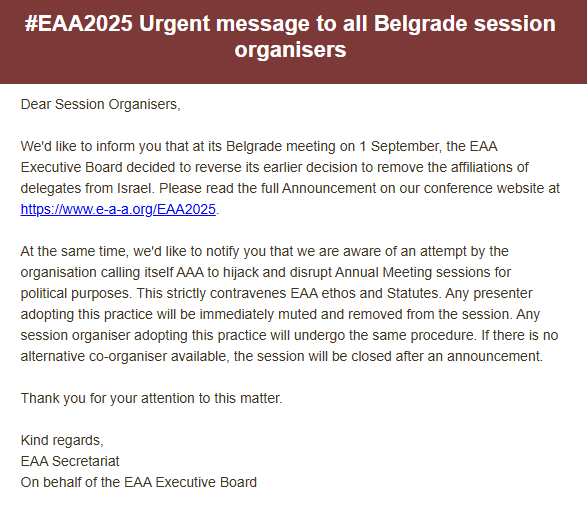
<img src="/assets/images/eaa1.png" alt="eaa" /></p>

<p>The removal of the institutional affiliation is in my view silly and don’t really serve anything. I don’t support collective punishment of anyone just because of the actions of their government. Should any individual be inciting violence, calling for genocide, or behaving in any other way against the code of conduct/statutes etc. of the EAA then it is sure right to expose such individual and exclude them for the organisation, but in my opinion this must be evaluated on case-by-case basis. In the same email, the organizers wanted to warn us that there might be attempts to disrupt the conference “for political purposes” so likely a pro-Palestine protest of a sort. And then another thing happened…
On the same day September 2nd just shortly before the start of the conference an email addressed to volunteers (managing meeting rooms on zoom) got leaked to the public. The content is simple: we anticipate disruptions - in the <strong><em>form of reading a political statement</em></strong> - should this happen, remove the individual from the session, if such an individual is a session organizer, the session will be cancelled.
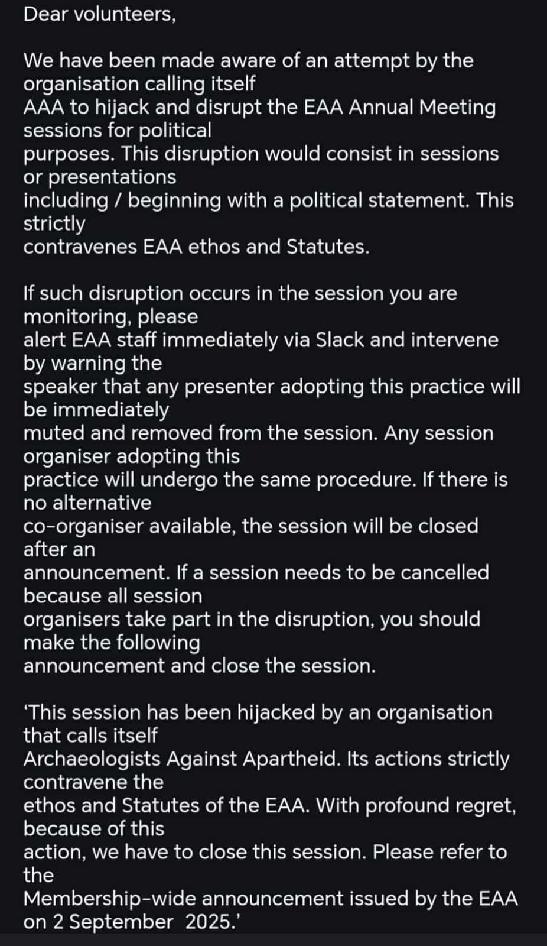
<img src="/assets/images/volunteer.jpg" alt="volunteer" /></p>

<p>This obviously enraged many people (me included) - they basically asked volunteers to kick you out of a session just for expressing your opinion. Generally, I am not a big fan of making political statements on archaeological conferences. I think it is not a right platform for this kind of expression, with exceptions directly related to our domain, such as defense of cultural heritage, academic life and freedoms and such. But don’t get me wrong - I don’t want to <strong>ban</strong> people from conferences for <strong>expressing their opinions</strong> like EAA attempted. So now there were people upset about reversal of decision on Israeli affiliations and people upset about suppression of free speech, and people who were not political before the conference got very political overnight. With our session organizers we discussed if we should boycott the conference or make statements at the beginning of the session and see what happens. I want to proceed with the session as I felt it would be unfair to the speakers who were prepared to deliver their presentations. We decided to make a statement and proceed. Obviously at that time (Wednesday morning) there was a big humbug about it with everyone talking and EAA attempted some damage control saying that you won’t be kicked out of session for this etc. So our session (despite some technical difficulties) could proceed quite normally.</p>

<p>Something should happen at the EAA so that collective punishment is not meted out to people for living in the “wrong” country, and so that open and free discussion can be maintained at the conference, even for people you disagree with.</p>]]></content><author><name>Adam Pažout</name></author><summary type="html"><![CDATA[Days are getting shorter and nights colder, clear sign that summer is slowly coming to an end and autumn, and new academic year, is coming. In my last post I mentioned that my summer in fact is going to be quite busy as I need to work on a least-cost path network model of the Roman roads in the Levant and prepare for presenting it at the EAA (European Association of Archaeology) conference that unfolded last week (2-6 September). And busy summer it was…]]></summary></entry><entry><title type="html">Busy conference season and plans for summer</title><link href="https://pazadam.github.io/news/2025/06/15/conferences/" rel="alternate" type="text/html" title="Busy conference season and plans for summer" /><published>2025-06-15T00:00:00+00:00</published><updated>2025-06-15T00:00:00+00:00</updated><id>https://pazadam.github.io/news/2025/06/15/conferences</id><content type="html" xml:base="https://pazadam.github.io/news/2025/06/15/conferences/"><![CDATA[<p>Past couple of weeks were quite busy on my part. As I advertised in my previous post, I went to Athens for <strong>Computer Applications in Archaeology</strong> conference at the beginning of May to present my work on the analysis of the Roman road data stemming from Work Package 1 of the <strong>VIA-TARIQ Project</strong>.
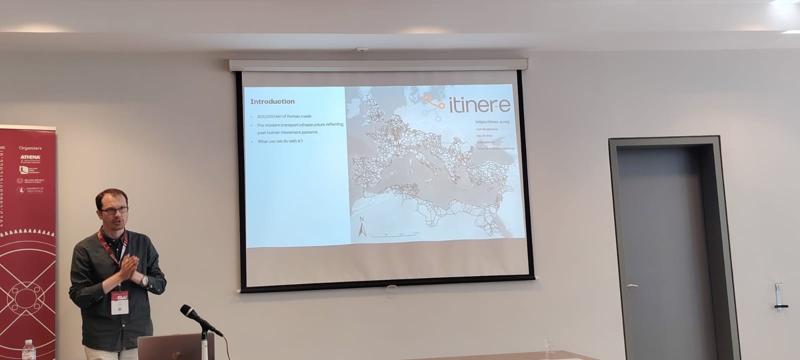
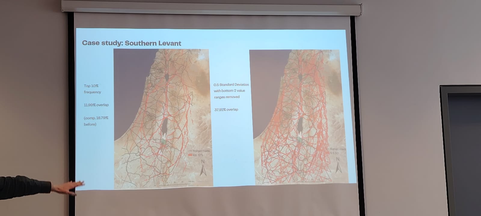
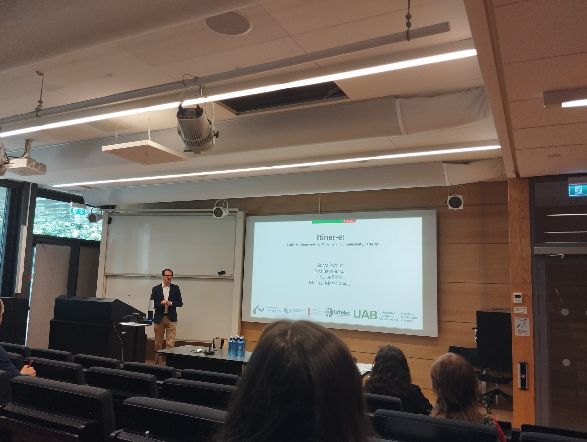
<img src="/assets/images/caa1.jpeg" alt="CAA 2025" />
<img src="/assets/images/caa2.jpeg" alt="CAA 2025" />
It was really great to come to Athens and be part of the wholesome community of digital archaeologists, meet old friends, make new acquaintances, and learn about all the new exciting research in computational methods in archaeology. Due to my interests, I am obviously more closely following developments in modelling the movement in archaeology, landscape archaeology, and human-environmental interactions, but it was very intriguing to see emerging applications of AI (still mostly machine-learning, with little in the field of language models in fact) in archaeology.</p>

<p>Regardless, after my presentation at the CAA and some discussion with my colleagues I decided to update the case study of my movement model (focusing on the Southern Levant) to be more commensurable with the “big” movement model for the whole Levant. And I presented this updated model at the <strong>Počítačová podpora v archeologii</strong> conference (Czech/Slovak chapter of the international CAA) in lovely town of Broumov, Czechia on May 26-28.
<img src="/assets/images/ppa.png" alt="PPA 2025" />
It was good opportunity to re-connect with Czech and Slovak colleagues and to see what is happening in Czech and Slovak archaeology - again it seems that a lot of AI applications are being developed, especially for image classification (remote sensing and archives!) and processing of large archaeometric datasets.</p>

<p>I finished this busy schedule with a workshop at Lund University <strong>‘Connecting the Ancient Mediterranean: Approaches, Evidence, and Case Studies’</strong> organized by Maria Moreno, where I presented our work on the <a href="https://itiner-e.org/">Itiner-e</a> and the analysis of the Roman road dataset.
<img src="/assets/images/lund.jpeg" alt="Lund" />
Maria managed to get together very diverse group of people working on various facets of mobility, both terrestrial and water-borne, in the antiquity. It was reassuring to see that there are more people interested in transport and mobility in the ancient times, who encounter similar methodological and theoretical challenges as us. I’ll be happy to keep in touch with all of them! Big thanks goes to Maria for excellent organization!
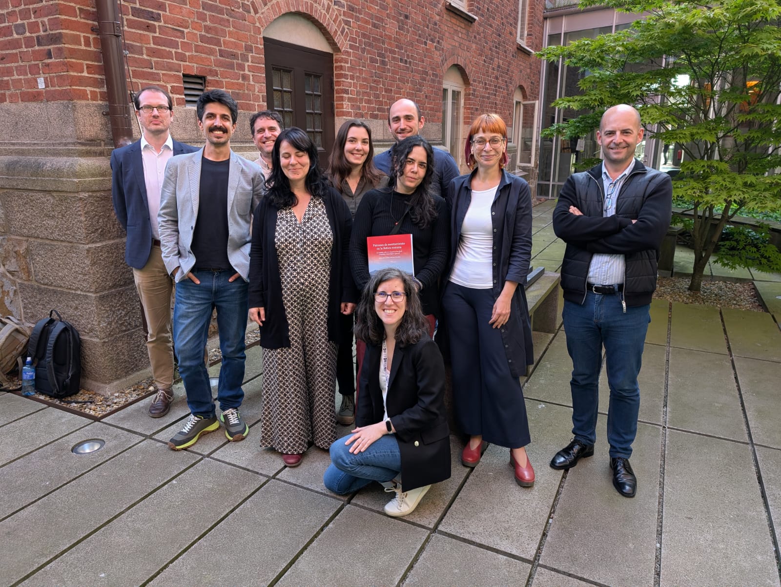
<img src="/assets/images/lund2.jpeg" alt="Lund again" /></p>

<p>One of the main takeaways of the WP 1 of VIA-TARIQ project is, that the location of Roman roads in the Levant is only partially driven by topographical constraints. When modelling ‘natural corridors of movement’ i.e., areas in the landscape that are more conductive to movement than others, only ca. 20% of the length of Roman roads coincide with them. This tells me that ca. 80% of the location of Roman roads can be explained either by a) additional topographical/environmental factors which I did not take into account initially, or b) their location is mostly driven by socio-cultural variables. For this reason, I’ll be now focusing on modelling theoretical least-cost path networks using a dataset of settlements covering Hellenistic to Byzantine period in the Levant (quite painstakingly collected over the spring) and comparing them to the evidence for the Roman road network in the region. It seems like a busy summer.</p>

<p><em>Many thanks to Angel Grigorov, Pavel Kacl, and Maria Coto for the photos.</em></p>]]></content><author><name>Adam Pažout</name></author><summary type="html"><![CDATA[Past couple of weeks were quite busy on my part. As I advertised in my previous post, I went to Athens for Computer Applications in Archaeology conference at the beginning of May to present my work on the analysis of the Roman road data stemming from Work Package 1 of the VIA-TARIQ Project. It was really great to come to Athens and be part of the wholesome community of digital archaeologists, meet old friends, make new acquaintances, and learn about all the new exciting research in computational methods in archaeology. Due to my interests, I am obviously more closely following developments in modelling the movement in archaeology, landscape archaeology, and human-environmental interactions, but it was very intriguing to see emerging applications of AI (still mostly machine-learning, with little in the field of language models in fact) in archaeology.]]></summary></entry><entry><title type="html">CAA conference 2025</title><link href="https://pazadam.github.io/news/2025/04/28/caa2025/" rel="alternate" type="text/html" title="CAA conference 2025" /><published>2025-04-28T00:00:00+00:00</published><updated>2025-04-28T00:00:00+00:00</updated><id>https://pazadam.github.io/news/2025/04/28/caa2025</id><content type="html" xml:base="https://pazadam.github.io/news/2025/04/28/caa2025/"><![CDATA[<p>Looking forward to present my latest research at <a href="https://2025.caaconference.org">CAA 2025</a> next week! I’ll be presenting my paper <strong>From roads to landscape and back: Using Roman road data to understand past movement</strong> (together with Tom Brughmans) in session 35 <em>‘Mapping and modelling movement in archaeology: From least cost analysis to diffusion pathways’</em>. Check the program of our session below:
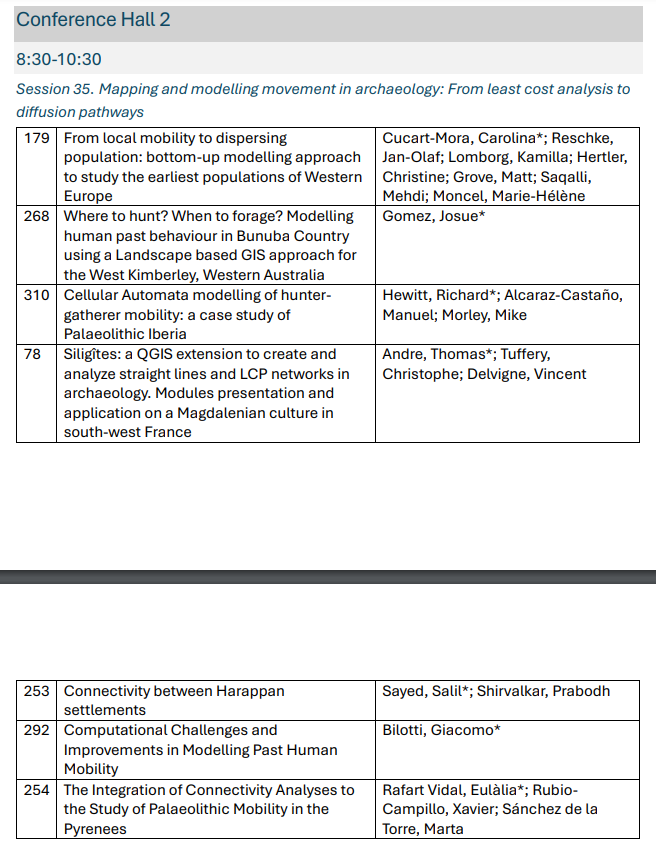
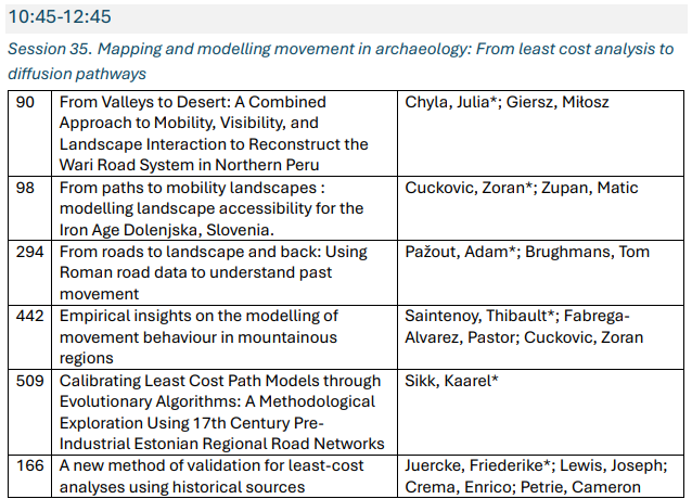
<img src="/assets/images/caa2025_1.png" alt="Session 35 CAA 2025" /> <img src="/assets/images/caa2025_2.png" alt="Session 35 CAA 2025" /></p>

<p><img src="/assets/images/caa2025.png" alt="Session 35 CAA 2025" /></p>]]></content><author><name>Adam Pažout</name></author><summary type="html"><![CDATA[Looking forward to present my latest research at CAA 2025 next week! I’ll be presenting my paper From roads to landscape and back: Using Roman road data to understand past movement (together with Tom Brughmans) in session 35 ‘Mapping and modelling movement in archaeology: From least cost analysis to diffusion pathways’. Check the program of our session below:]]></summary></entry><entry><title type="html">Site is up and running!</title><link href="https://pazadam.github.io/news/2025/04/28/site-is-up/" rel="alternate" type="text/html" title="Site is up and running!" /><published>2025-04-28T00:00:00+00:00</published><updated>2025-04-28T00:00:00+00:00</updated><id>https://pazadam.github.io/news/2025/04/28/site-is-up</id><content type="html" xml:base="https://pazadam.github.io/news/2025/04/28/site-is-up/"><![CDATA[<p>Project site is up and running!</p>]]></content><author><name>Adam Pažout</name></author><summary type="html"><![CDATA[Project site is up and running!]]></summary></entry></feed>